

Maps are so old school. You can’t edit them (lame!), there’s no zoom (boring), and the static landscape of frozen pixels doesn’t change to show new trails (WTF?). They’re also often inaccurate, drawn before the time of high-end GPS.
Twenty-five-year-old twins Brian and Brandon Reavis of Cody, Wyoming, consider these issues to be hopeless failings with traditional maps. Their solution: , a “live” archive of crowdsourced maps built by the people who are actually using the trails.
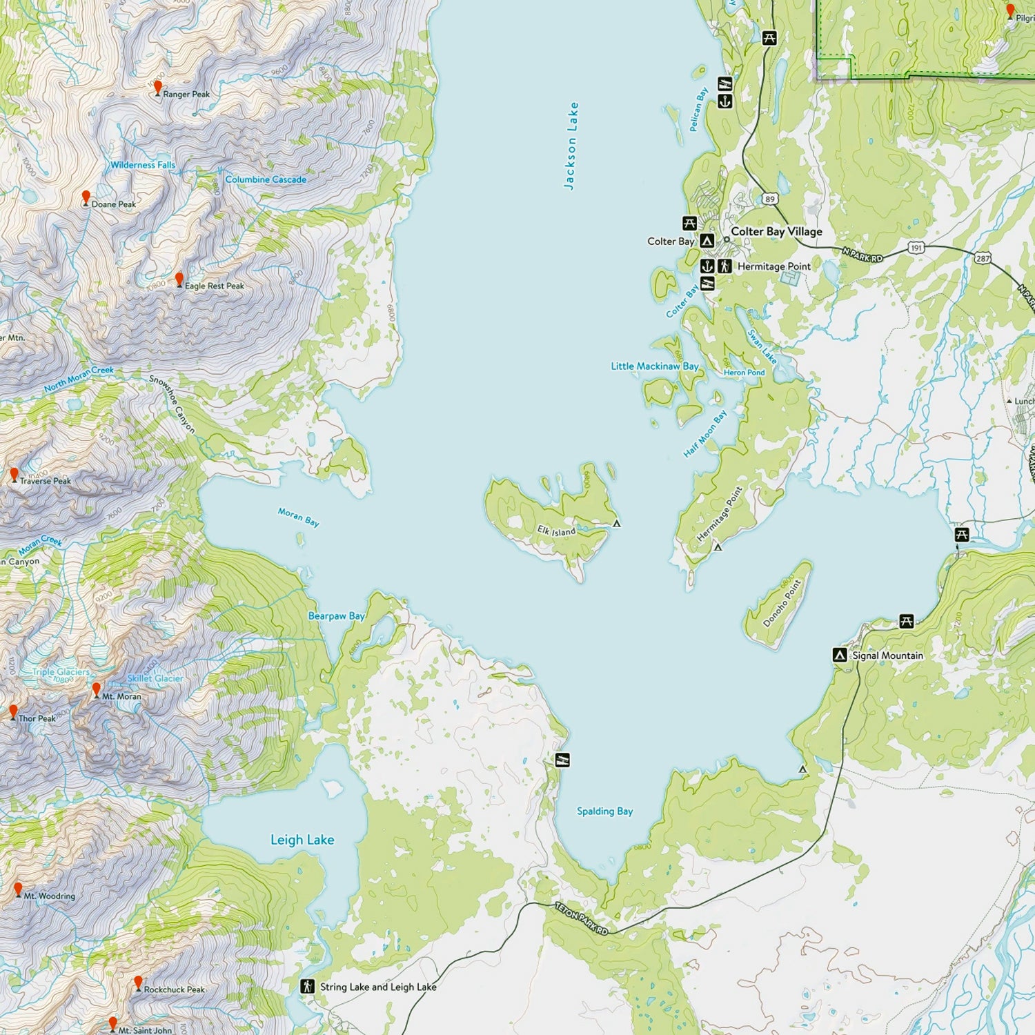
The digital resource is open and editable to everyone. It uses data from government agencies, including the U.S. Forest Service and the USGS, in addition to the boots-on-the-ground info it gathers from users.
Natural Atlas’ marks everything from resurgent domes to couloirs, boat ramps to campgrounds, giving each its proper label and making sure the features are current.
The model is a graphic form of Wikipedia, designed “specifically for the outdoors,” says Brian. “On Wikipedia, you might find a page on a peak, but not on the small creek beside it.”
Sure, in many regions, you can find these details outlined on countless blogs, but the info is disorganized, requires lots of searching, and rarely includes accurate maps. The idea behind Natural Atlas is to offer all those locals’ tips on a single, authoritative site.
It’s also meant to be multisport. “We can’t have something that’s just for climbers or just for anglers or only for hunters. Wikipedia isn’t like that,” Reavis says. The too-narrow focus not only misses the potential of crowdsourcing from multiple interest groups, he says, but also ignores the fact that useful info for one group (say, CFMs for paddlers) is useful to another (hikers trying to cross the stream).
There’s huge potential for winter mapping, too. A USGS map doesn’t show the skin lines at Teton Pass. Likewise, it doesn’t show ice climbs or their condition.
So far, the brothers, who quit their day jobs, are focusing locally, on Wyoming, Montana, and Idaho. (They wouldn’t divulge how many users the site currently has.) The plan is to have Natural Atlas cover the entire country in 2016.
Natural Atlas is still young and needs to keep building its archive to attract more users. It’s a chicken-and-egg problem, but adding Utah, the next state on the brothers’ list, should help. They make money by charging users $30 for premium features like map printing and exporting to GPS, and have so far resisted selling ad space to keep the user experience as clean and enjoyable as possible.
For now, users can download maps from the Natural Atlas site. The twins plan to begin work on an app later next year.