

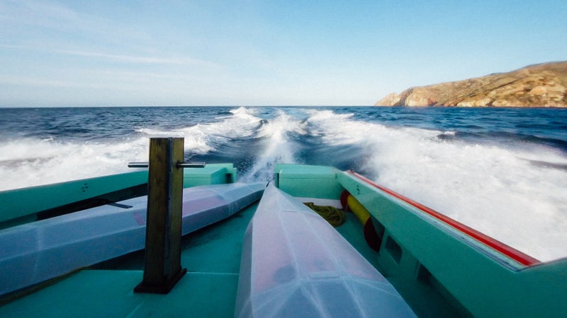
At 4:10 a.m. on Friday April 22, an Uber driver dropped Emilio and I off at the entrance of Abalone Cove Shoreline Park in Palos Verdes, CaliforniaтАФalong with our two . At 6:30 a.m., we launched the 16-foot-long corrugated plastic origami vessels into the surf, with our sights set on paddling to Two Harbors on Catalina Island,┬аtwenty-something miles away.
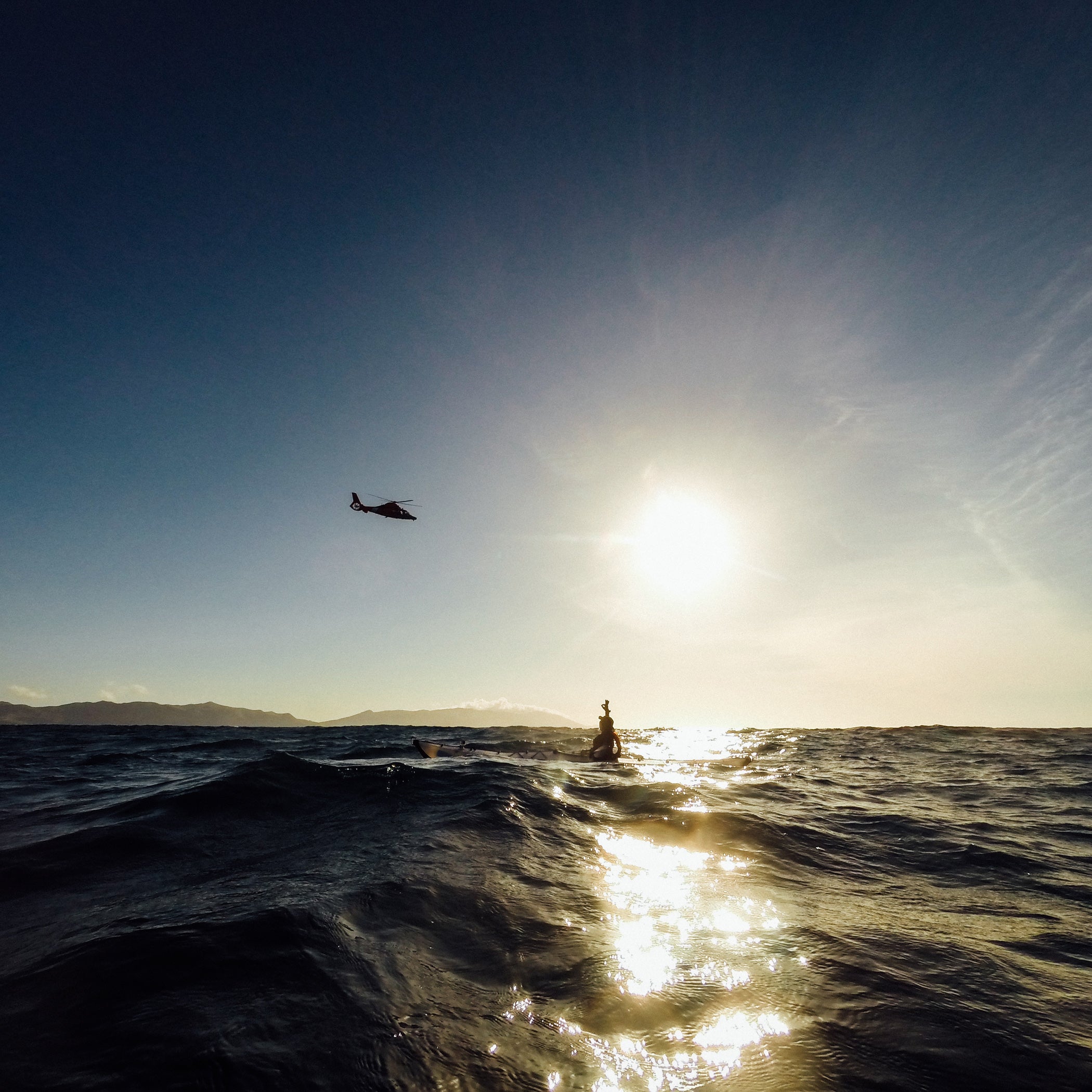
Nineteen miles into our journey, Catalina Island filled the horizon. We could resolve the details of buildings, trees, and hiking trails. Then at approximately 5:30 p.m.,┬аwith just four or five miles left to paddle until landfall, Emilio and I agreed to call in тАЬMayday, mayday, maydayтАЭ on our VHF marine radio. A small craft advisory had come into effect that afternoon, and┬аstrong winds had blown us about six miles south of our intended course. We had been battling the gale since 2 p.m. and were barely making any headway. Nightfall was near.╠¤We wouldтАЩve never make it back up to Two Harbors with the current conditions, so we decided to ask for help. HereтАЩs how we did it, and what we learned from the experience.
Preparation
When planning any sort of adventure, itтАЩs imperative to leave a detailed itinerary with someone you can trust. In this case, Emilio and I left one with our girlfriends, who had taken the ferry across that same morning and were waiting for us in Two Harbors. We had also provided them with a link to track our progress which was being transmitted through a DeLorme InReach Explorer that we carried during the trip. In addition to providing GPS tracking intervals and two way satellite communication via SMS (never rely on your phone when venturing out into the wilderness,) the InReach also features a one-push SOS button that can be used in the event of an emergency. However, we instead relied on a VHF marine radio for communicationтАФand used the InReach to provide real time GPS coordinates.
These electronic devices are weatherproof, but cannot be submerged underwater, so keep them inside of a waterproof dry sack when not in use. If you're kayaking, the dry sack can be stored in a fanny pack for quick access. ItтАЩs also a good idea to have a whistleтАФand a couple of signaling devices like a mirror and flare gun to help make other vessels aware of your position.
Additionally, since this was an unsupported crossing attempt, we each carried about two gallons of easily accessible freshwater. Since we would be almost constantly paddling, Emilio and I drank from hydration bladders and sipped regularly to stay hydrated throughout the day. In addition to water, we each carried several thousand caloriesтАЩ worth of snacks in the form of meal bars, energy gels, and chews. These would provide for quick, easy-to-consume nutrition throughout the day. What we failed to consider was the possibility of seasickness; as such, we did not carry any remedies such as ginger or Dramamine. This would prove to be a discouragingтАФbut not defeatingтАФmistake.
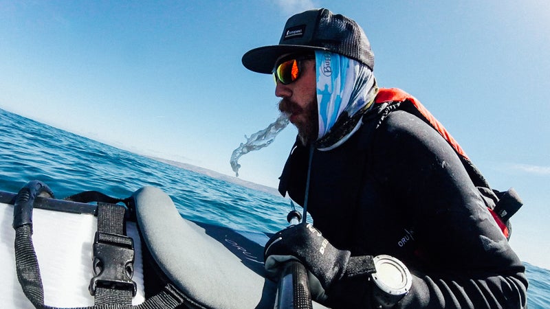
We also wore wetsuits (the did the trick for me) sun hats, Buffs, wrap-around sunglasses, sunscreen, neoprene gloves and booties, and boat shoes for protection from the elementsтАФin addition to our Coast Guard-certified PFDs.
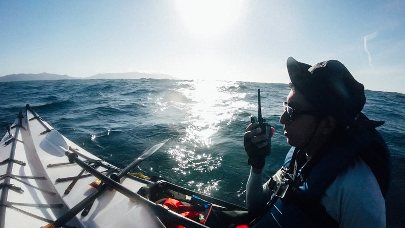
Most importantly, we carried a GPS, and a VHF marine radio. When venturing out onto open water, itтАЩs imperative to carry these. ItтАЩs equally important that you know how to use them. These are the basics.
GPS Receiver
A dedicated, handheld GPS receiver can accurately calculate time and location by receiving information from GPS satellites. The receiver will display your location using geographic coordinates in the Degrees, Minutes, and Seconds (DMS) format which will look something like this: 33┬░29'10.7″N+118┬░27'22.8″W.
A GPS receiver like the InReach Explorer can also be used to plot a route and track metrics such as speed and distance traveled. Each model varies, so be sure to familiarize yourself with its functions before venturing out. We used ours primarily to recall our location for Search and Rescue.
VHF Marine Radio
VHF stands for тАЬVery High Frequency,тАЭ which is the spectrum that Marine Band channels operate on. If your vessel is non-powered, like our lowly kayaks, youтАЩll want to carry a handheld model. These are less powerful than fixed-mount units, but theyтАЩre just as versatile and will definitely get the job done. This is the single most important piece of equipment that you can carry while traveling on open water.
Before using your VHF marine radio, itтАЩs important to understand what itтАЩs for, how you should use it, and how to not be an idiot on its open channels. First, keep in mind that any conversation on any of its bands is public. This means that anyone tuned into the same frequency as you can listen in on a conversation. Marine channels are also not designed for frivolous chatter, which can prevent frequencies from being utilized by people who actually need them. Regulations require radio chatter to be for operational purposes only. Relaying weather information, setting up a rendezvous, or calling for help are all appropriate uses. Even then, keep conversations short and to the point. The most important channel that you should be aware of is Channel 16, which is for international distress, safety, and calling. You should at the very least, know how to call for help using this channel.
What to Do When SHTF
When a situation escalates beyond your comfort zone, the most important measure is to stay calm. If adventuring with a partner or as part of a team, itтАЩs also important to be attuned to your partyтАЩs condition. Your comfort zone may not be aligned with theirs; if youтАЩre the team leader, you must respect your teamтАЩs needs. ThereтАЩs a time to push through,┬аthereтАЩs a time to let up or seek alternate measures than originally planned. This is dependent upon the team.
Emilio and I were fighting a losing battle due to the high winds at sea. Despite our best efforts, we were being pushed further and further away from our final destination of Two Harbors. As much as both of us desperately wanted to make landfall and complete our journey, we determined that the best course of action for us was to use the VHF marine radio to call for help. HereтАЩs how to do it.
If your situation is dire (ie: life and death, serious injury, sinking vessel, etc.,) key in channel 16 and call тАЬMayday, mayday, mayday.тАЭ If your situation is under control, but has the potential to get worse (ie: taking on water,) key in the channel and call тАЬPan-pan, pan-pan, pan-panтАЭ (pronounced тАЬpawn-pawn.тАЭ) Follow both by your vesselтАЩs name or description (ie. we were тАЬTwo Kayakers in DistressтАЭ) and repeat the name three times. Then give your waypoints (which can be found using your GPS) and state any geographical references. Follow that with a description of your situation or emergency, including the number of people on-board as well as their condition. Sign off by repeating your vesselтАЩs name once more; then unkey the channel on your radio.
The Coast Guard monitors channel 16 and will likely ask you to respond with a тАЬlong count,тАЭ which will enable them to determine your general location based on the transmission. To do a long count, simply count slowly from one to ten; then back down from ten to one.
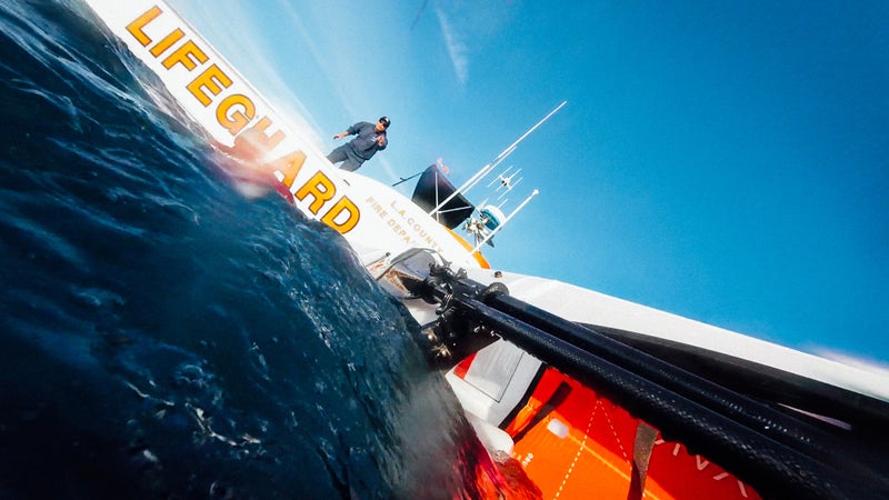
Once the Coast Guard determines your location, they will reach out to any vessels in the area, seeking assistance on your behalf. Once contact with an available vessel in the vicinity has been established, the Coast Guard will ask for your updated location and relay that to the rescue vessel. In our case, it was a Los Angeles County Fire Department patrol boat stationed at Two Harbors nearby.
While waiting for your rescue, remain calm, attentive, and in control of yourself. The environment will almost certainly be out of your control, but how you react to it is up to you. Panicking or stressing out will not help the situation in any way, so take deep breaths and remain calm. Depending on how remote your position is, rescue could take anywhere from a few minutes to a few hours. In extreme cases, it could even take days, weeks, or months. During this wait period, keep a close ear on your radio. The possibility of a drift is likely, so┬аyour rescuers may need periodic updates on your location.
Once the rescuers arrive, the situationтАЩs intensity will likely increase due to new variables in the form of rescue craft and crewтАФas well as additional noise, wake, and communication. Again, remain calm. Listen carefully to the rescuers instructions and comply to the best of your abilities. ItтАЩll all be over soon.
So How Much Will Search and Rescue Cost You?
This was the first question that we asked once aboard the LAFD patrol boat. The answer, in short, is nothing (unless youтАЩre in a few select states). , in regards to a familyтАЩs rescue off the coast of Mexico in 2014, the Coast Guard is тАЬhere to provide a public service to U.S. citizens in distress.'' A spokesperson for the California Air National Guard, agreed: “Bottom line, you can't put a price on life.'' These rescues are funded by taxpayer dollarsтАФwhich is a great reason to not abuse the privilege of SAR.
What Could We Have Done Differently?
While planning our adventure, Emilio and I had expected forecasted winds throughout the afternoon.╠¤According to LAFD Baywatch Isthmus captain Steve Kirkland, who rescued us along with ocean lifeguard specialist Dustin Stevens, the Small Craft Advisory didnтАЩt go into effect until after we were already out. At that point, Emilio and I could have been monitoring the National Oceanic and Atmospheric AdministrationтАЩs weather channel on our VHF marine radio, which would have allowed for us to adjust our course south and paddle with the wind at our backs to AvalonтАФinstead of fighting against the gale for hours on end.
While neither Emilio nor I were stoked having to be rescuedтАФor having to abandon our mission so close to its completionтАФwe are grateful for the experience and expanded perspective on marine search and rescue. With this experience under our belts and Captain KirklandтАЩs blessing, weтАЩll undoubtedly be attempting Catalina Channel crossing againтАФalbeit more prepared for the full day at sea.