

Why has it been so warm and dry out West? That’s a question just about everyone left of��the Rockies has puzzled over these past few years. As the eastern U.S. has found itself facing the brunt of “Snowpocalypses,” “Snowmageddons,” and other remarkable winter-weather events, historically verdant states like California and Colorado have been slowly fading into a worrisome shade of brown for more than a decade.
Rainfall and snowpack in the West have dwindled to record lows, but those are merely symptoms of a larger, persistent atmospheric configuration that has become essentially stuck in place over the past several years. Because of that, it’s worth looking��to the skies for clues about the origins of the West's water woes. Here’s a (literal) top-down approach to understanding what is causing the drought in the West:
The Rise of the “Ridiculously Resilient Ridge”
California's climate is typically characterized by a reliable annual cycle of precipitation, with predictably wet winters and almost invariably dry summers. A relatively small handful of winter storms during the typical October-to-May “wet season” are responsible for a majority of the rain and snow that falls in the Golden State in any given year. But this parade of storms has been interrupted for the past four years by��an atmospheric anomaly I call the “” (or the Triple R).
The Triple R is a region of unusually high atmopsheric��pressure hanging around the northeastern Pacific Ocean. It��prevents��the Pacific jet stream and associated stormy weather out of the Arctic from traveling to much of the West Coast. Storms that otherwise might have hit San Francisco or Los Angeles are instead re-directed to Anchorage and Vancouver, bringing even rainier conditions to already wet places and leaving California dry. Other parts of the American Southwest have experienced dry conditions as a consequence of the Triple R, but three-year precipitation shortfalls are currently much larger in California than anywhere else in the West.
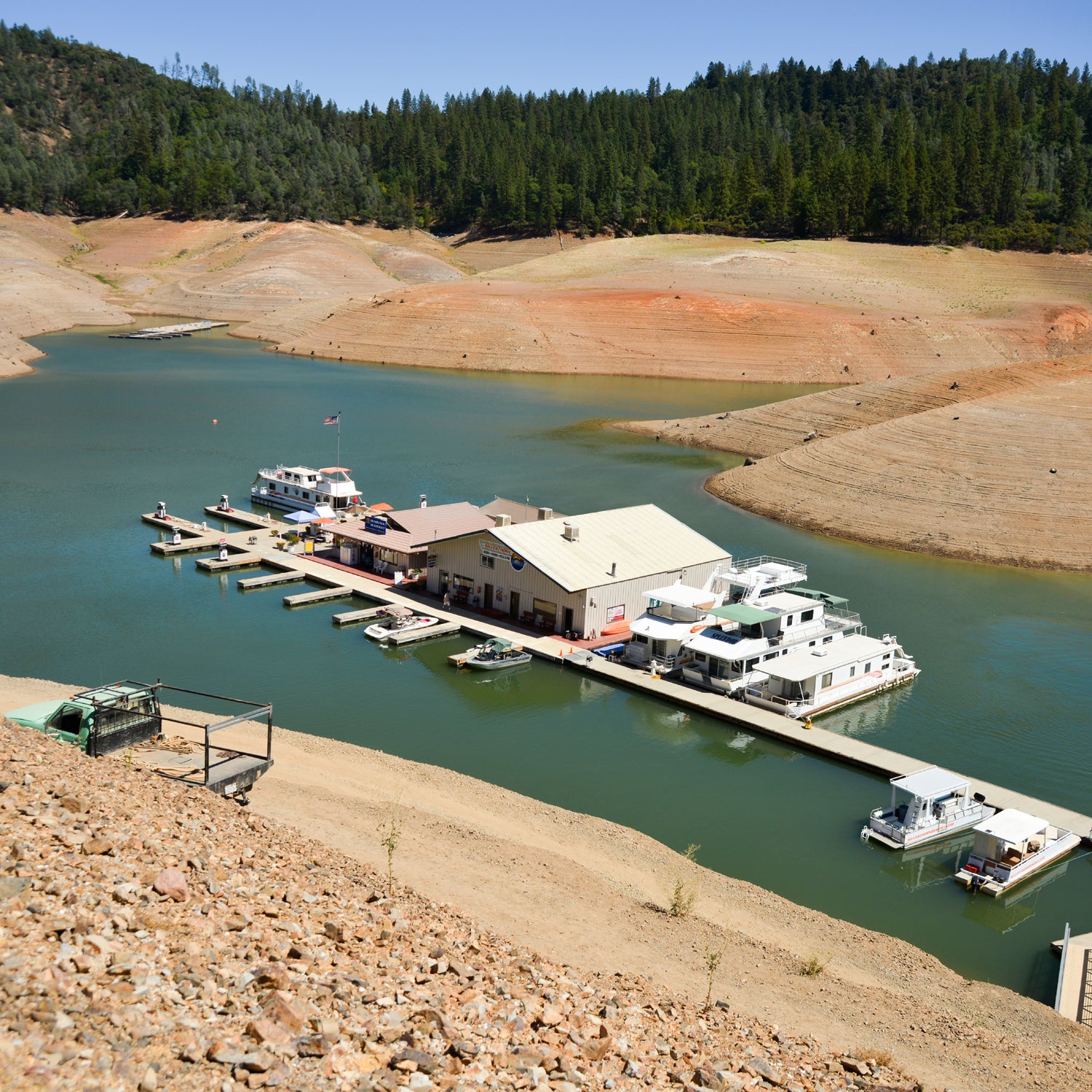
The Great Western Snow Drought of 2015
Striking photographs of snowless mountain peaks in the heart of winter—and recent news that the amount of water stored in California’s mountain snowpack is almost nonexistent—have highlighted the role of high temperatures in amplifying the severity of existing drought conditions. But these incredibly warm temperatures have not been confined to California: unprecedented warmth has led to extremely low snowpack conditions across nearly the entire West this year.
Even in places that have received plenty of precipitation—like the Cascades of Washington and Oregon—it's��fallen as rain rather than snow, leaving many mountain slopes bare even after winter storms roll through. At the same time, prolonged dry spells and extended stretches of well-above-freezing high-elevation temperatures in between storms��have allowed what little snow has fallen to melt during the heart of winter—precisely the time of year when the white stuff should have been accumulating.
An increasingly big part of the Western temperature story is the extraordinarily warm Pacific Ocean. A region of unusually high water temperatures in the far northeastern Pacific—affectionately nicknamed “” by oceanographers—have translated into warmer, wetter storms moving in off the Pacific, bringing warmer rain at very high elevations all up and down the Pacific Coast.��
Why Is the Triple R So Persistent?
The short answer: We don’t have a clear answer yet.
It appears increasingly likely, though, that an unusually warm western tropical Pacific Ocean—as far away as the waters east of Indonesia and the Philippines—is playing a big role. Powerful tropical thunderstorms, driven by anomalously warm ocean water, can pump vast amounts of heat high into the tropical atmosphere, where it meets with cooler air from the north. This convergence strengthens the high-altitude wind, known as the “jet stream,”��that helps to guide the trajectory��of storms across the Pacific.��But an unusual injection of jet stream energy can also lead to thousand-mile-wide kinks in the jet stream's west-to-east flow and redirect storms away form the U.S. West Coast.��Such conditions��have allowed the Triple R to develop and maintain its stability.
It’s also possible that the rapid loss of Arctic ice and snow is having an effect on the Pacific jet stream at certain times of year. Just as unusually warm ocean water in the tropics can increase temperature contrasts in the atmosphere above, so too can unusually warm ocean waters in the Arctic (caused by a lack of sea ice) or unusually cold land temperatures (caused by abundant Siberian snowfall), which in turn��affects the path��of weather systems across the Pacific. And it just so happens that the changes we’ve observed in the high-latitudes may be in sync��with oceanic oscillations that favor a big, circuitous loop in the jet stream near western North America—one highly reminiscent of the Triple R.
To make things even more complicated, there’s growing evidence that all of these possible influencing factors are being affected by global warming. We already know that the American West has warmed considerably over the past century, which has contributed to the observed loss of winter and spring snowpack in many regions and increased the overall risk of drought in California. But the degree to which long-term changes in climate are influencing the likelihood of seeing warm��winters like we’ve experienced recently remains a fascinating open question—one to which scientists are actively seeking an answer.��
A Brief Look Ahead
While there’s currently some hope that a developing El Niño event in the Pacific Ocean might bring partial relief to the West Coast toward the end of 2015, that possibility remains highly speculative at the moment. One thing we do know with certainty, though, is that a long, dry summer awaits California and the rest of the West.��And in spite of (and a record for the wettest month in Colorado)��there are widespread expectations that 2015 could feature one of the worst wildfire seasons in living memory—largely on account of ongoing severe drought conditions and the astonishing lack of mountain snowpack in 2015. So in the meantime, at least, the legacy of the Triple R lives on.
Daniel Swain is a PhD student in the Department of��Earth System Science program at Stanford University. He authors��the blog .��