

For the first time since 2013, Google has updated its satellite imagery of planet earth. The new images have more detail and truer colors, giving civilians more data than has ever been available. Let’s look at what’s changed and talk about how it can help you.
What’s New?
Google Earth works by analyzing trillions of pixels worth of satellite images, selecting the clearest, cloud-free ones, then stitching them all together into one seamless image of the planet. Pause for a second and consider what a technical achievement that is. Just one generation ago, we didn’t even have complete maps for the earth. Now you can scroll across every inch of it in high-resolution.
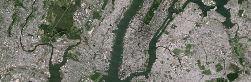
The previous iteration of Google Earth was powered by images from the Landsat 7, which was launched way back in 1999 and photographed the earth with a pixel size of 30 meters. That satellite suffered a hardware failure in 2003, resulting in large diagonal gaps of missing data in the imagery it produced. Now we’re seeing images from Landsat 8, which was launched in 2013, and has a pixel size of 15 meters, in addition to other improved capabilities.
:��
“Landsat 8 captures images with greater detail, truer colors, and at an unprecedented frequency—capturing twice as many images as Landsat 7 does every day. This new rendition of Earth uses the most recent data available—mostly from Landsat 8—making it our freshest global mosaic to date. Like our previous mosaic, we mined data from nearly a petabyte of Landsat imagery—that’s more than 700 trillion individual pixels—to choose the best cloud-free pixels. To put that in perspective, 700 trillion pixels is 7,000 times more pixels than the estimated number of stars in the Milky Way Galaxy, or 70 times more pixels than the estimated number of galaxies in the Universe.”
What Does This Do for You?
I’ve been using Google Earth to help inform travel planning since its launch in 2001. In addition to topographic and trail maps, it helps me assess conditions on the ground with far more information. I can see the location, density, and types of trees, for instance, as well as the presence of tracks and trails that may not be included on traditional maps. What can that additional information give you?
Determine Volume of Use
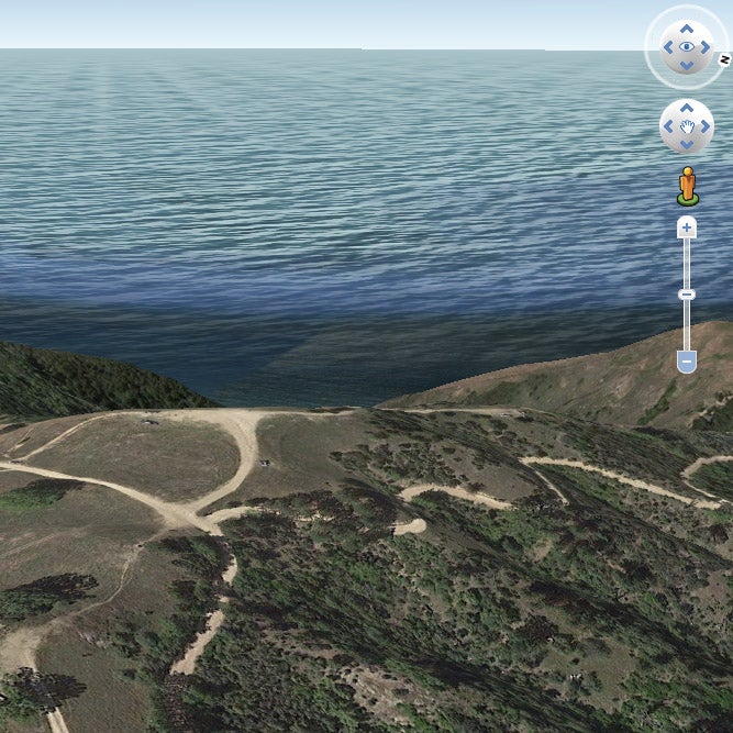
Is a spot you want to visit going to be pristine or packed with people and trash? Now with the ability to make out even faint tire tracks, you can instantly tell if people have been there before, how often, and how damaged that location may be. Just zoom in and look for signs of human presence. If you see lots of clearly defined, wide tire tracks and trails, you know an area gets a lot of use.
Gauge Severity of Climbs
Hiking, backpacking, cycling, or even rock climbing? You can look at the contour lines on a topo map, read trip reports, and find photos, but nothing allows you to fly through a landscape and develop a powerful sense of its challenge like Google Earth.
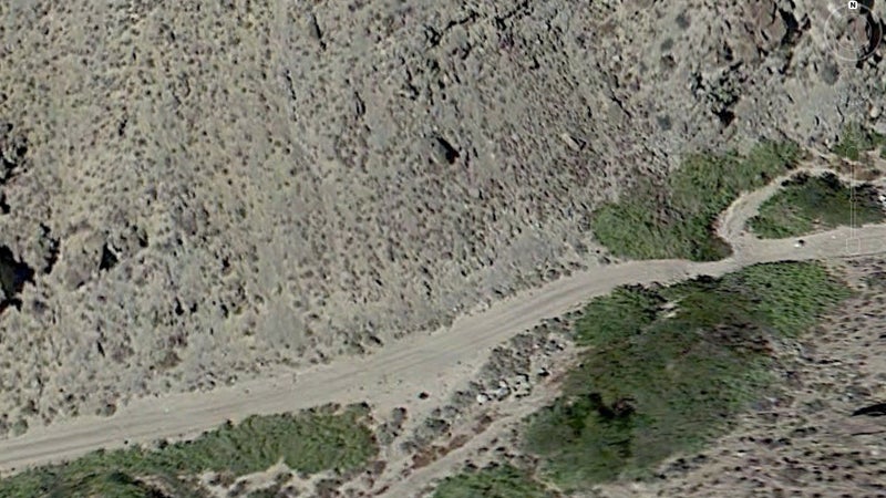
Assess Road Conditions
Back when I was driving a Subaru Outback instead of a built Land Rover, I had to take care choosing appropriate routes. Obviously Earth isn’t going to show you up-to-the-minute info on rock slides or washouts, but it can allow you to get a good overview of dirt road conditions. Is the dirt road, two-track, or fire road wide, clearly defined, free of overhanging trees, and devoid of water crossings? How steep are the slopes it climbs? Does the texture appear uniform or highly varied? Google Earth can give you more information on more miles of road, anywhere in the world, than you’ll ever find in forums or hear from friends.
Guesstimate Animal Patterns
Last fall, I picked up a cheap, leftover tag for deer in a zone with the lowest hunter success rate in California. Before driving up, I spent 20 minutes on Google Earth determining locations of water sources, grazing, daytime cover, and , then dropped a pin on where I thought my best odds of success lay. The next morning, I snuck toward that pin carrying my bow—and found a herd standing right were I predicted they’d be. If that pin had been real, it’d have done the job for me, but I did it with an arrow through the lungs half an hour into my first-ever visit to that area.
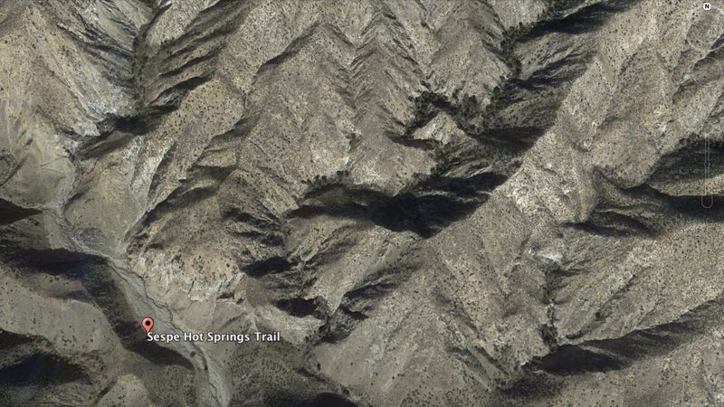
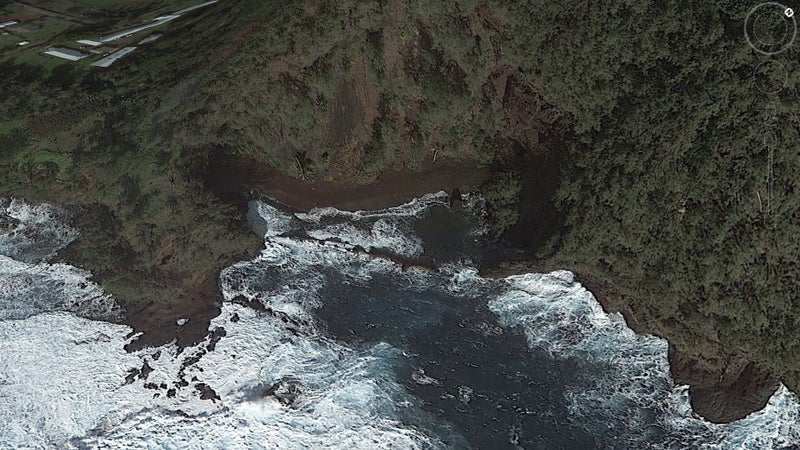
Find Hidden Gems
The shading on maps only gives you a general overview of flora and the indicated bodies of water are only informed by human experience. Earth allows you to sail over ridges, deep into the backcountry, and look for hidden streams and oases no one may have ever visited before or that at the very least aren’t common knowledge. I found the best campsite I’ve ever slept in this way, a spot way out on the coast of Labrador where I watched humpback whales jump just 100 yards away, then saw a pod of orcas hunting while the Northern Lights played overhead. The next morning, I feasted on cloud berries, walked within 10 feet of a bull moose, and swore to return.
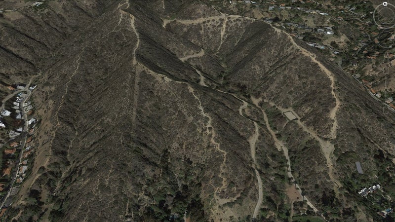
Find New Trails
In the Alps, you can ride a mountain bike on any established trail. That includes old Roman roads and 1,000-year-old walking paths. Want to find an all new route for yourself? “Fly” over any old settlement or fort (which were often built on peaks), look for the nearest water source, then zoom in and look for faint lines traveling between the ruins and the water. I just made your next vacation an epic one. You’re welcome.
Empower Everyday �����ԹϺ���s
Just looking for a new spot to hike, ski, bike, or walk the dog? Google Earth lets you see what’s over that next hill or in that valley, and determine if it’s worth visiting. Add layers like roads, boundaries, parks, etc., and you’ll be empowered with a whole new level of decision-making ability, allowing you to spend more time having fun. In Los Angeles right now, the mega-popular Runyon Canyon Park is closed. A lot of my friends are staying home instead of hiking, but I’ve been able to find new trails in the area using Google Earth, including ones that skirt the park’s boundaries, so I’m basically able to go hike with Wiley in the same place as before, all without any crowds. Pretty neat, right?
And that's just the basic stuff such powerful imagery allows you to find. What are your tips and tricks for using Google Earth? And, what have you found through it?