

Even if you’ve never set foot in New England, you probably know Katahdin by its reputation: Maine’s highest peak,Ěýthe storied terminus of the Appalachian Trail,Ěýthe spot where . You might not know that a hiker can’t simply show up at a trailhead thereĚýand start hoofing it up the mountain. Or that Katahdin isn’t found, as some reasonably assume, at Katahdin Woods and Waters National Monument, Ěýin 2016.Ěý(It’s next door.)ĚýYou almost certainly wouldn’t recognize the names of the other neighboring parks and preserves—each administered by a different outfit and governed by different rules—that together make the Katahdin region arguably the East Coast’s finest wilderness-recreation bloc.
And so, a primer. The patchwork management of Maine’s wild andĚýwoollyĚýnorth woods can be confusing for a first-time visitor. Here’s what a would-be Thoreau needs to know.
Baxter State Park
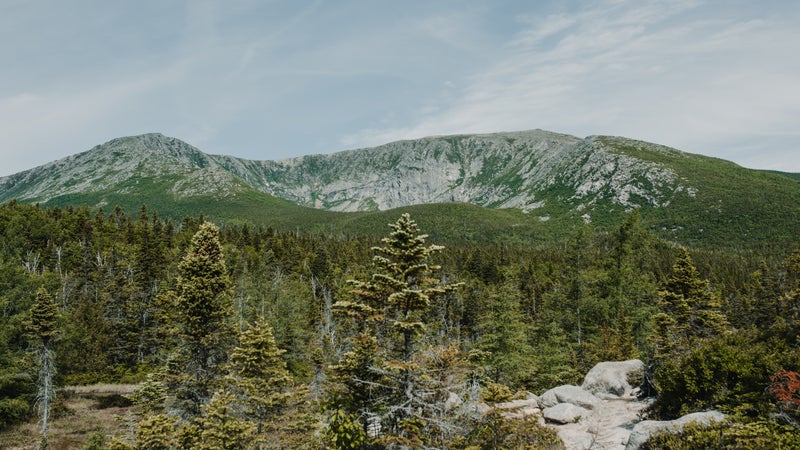
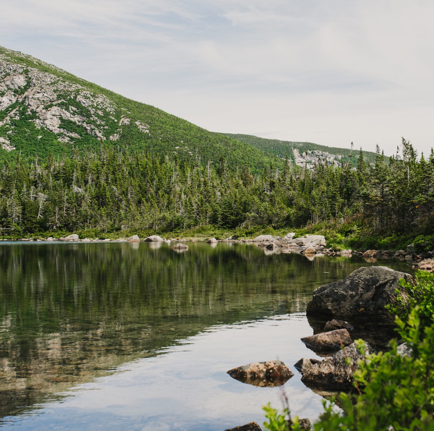
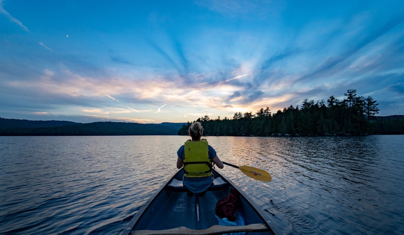
What’s there: Mile-high Katahdin, for one. More than a half-dozen intersecting trails reach its summit,Ěý, with most of them falling in the alpine zoneĚýfor miles and requiring some scrambling or climbing on iron rungs. AT thru-hikers start or finish their trek on the mountain’s western slope, but the showstopper is the eastern approach called the Knife Edge, a boulder-strewn ridge walk of just over a mile where the mountain’s spine is sometimes all of threeĚýfeet wideĚýwith a 2,000-foot dropĚýon either side. Less exhilarating but equally sublime is Chimney Pond, tucked into a cirque on the mountain’s north side, near a cluster of coveted .Ěý
But there’s more to Baxter than Katahdin. The 330-square-mile wilderness park encompasses more than 40 mountain peaks, backcountry ponds full of native brook trout, and a handful of idyllic cabins and campgrounds—all accessed by one gravel road and some 220 miles of trail. One of Maine’s most underrated hikes is the Traveler Mountain Loop, near the park’s north entrance, which stays above treeline for more than half of its 11 miles. The trail endsĚýat Traveler’s 3,551-foot summit, andĚýit has much of Katahdin’s grandeur and a fraction of its foot traffic.
Who runs it: The state, with limitations. Maine’s governor in the early twenties, Percival Baxter, wanted the state to acquire and protect Katahdin and its surroundings. His initiative failed, but after leaving officeĚýhe spent 30 years buying the landĚýand deeding it to the people of Maine. So while Baxter is a state park in name, it exists outside of Maine’s park system, legally bound by deeds forbidding anything that might intrude on its unique character.
Getting in: Entrance is free if you’re in a car with Maine plates; otherwiseĚýit’s $15. Things get tricky if you want to hike Katahdin. Unless you’re waking up inside the park (campsites and cabins book up months in advance), you’ll need a day-use parking reservation—a DUPR, or “dooper,” in Baxter parlance—to claim a space at a Katahdin trailhead. Non-residents can for $5 starting two weeks before a planned trip. On the morning of your DUPR, you must be at the park’s south entrance by 7 A.M.—at 7:01, your space goes up for grabs to the DUPR-less hopefuls who often hover outside the gate. Once the park admits enough cars to fill the trailhead lots, Katahdin has reached capacityĚýand you’re looking for an alternate hike.
Know before you go: Baxter has no cell service and no facilities with Wi-Fi. (Or electricity, for that matter.)ĚýThe entrance gates are within a few miles of campgrounds with stores, but you’ll find nothing for sale inside the park, so comeĚýprepared. Pets are forbidden, and kids under six can’t go above treeline—rangers will enforce both rules. Some trails have rather conservative cutoff times, and rangers may turn you around if you’re caught hitting the trail too late in the day. Baxter is a bit of a rule-happy park, and soĚý before heading in.Ěý
What’s nearby: The recovering mill town of Millinocket, an AT trail town where you can gear up atĚýĚýand eat amazing donuts at the ĚýwhileĚýadmiring thru-hikers’ signatures on the ceiling panels. Lodging in town is mostly budget motels, with a few campgrounds and lodges clustered outside the park entrance, including the sprawling .Ěý
Katahdin Woods and Waters National Monument
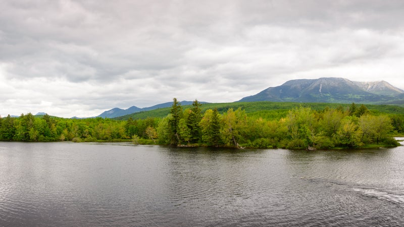
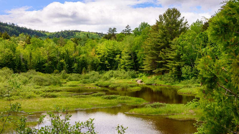
What’s there: Katahdin’s forested foothills, several of them bald-topped, their summits accessed along 30 miles of the . Mountain bikers comeĚýfor a few dozen miles of old forest roads, and paddlers watch for moose along the . The monument also has some of the planet’s best stargazing,Ěýas by the .Ěý
Who runs it: The , after President Obama’s Interior Department accepted a gift of 87,500 acres from ,Ěýthe Mainer cofounder of Burt’s Bees.Ěý
Getting in: As of yet, the monument has no entrance stations, so there’s no fee. Camping is free, too, available on a first-come, first-serve basis in a handful of primitive sites and lean-tos scattered throughout the park. Katahdin Woods and Waters abuts Baxter to the east, but it’s a wilderness border—you can't enterĚýone park from the other by car.Ěý
Know before you go: As a new NPS unit, the monument is still light on frontcountryĚýattractions, other than a 17-mile scenic driving loop withĚýoverlooks and interpretive displays thatĚýwill tax any lower-clearance vehicle. (As will all the monument’s roads.)ĚýThere’s no road connectingĚýthe monument’s north entrance to its south entrance, and it’s a 90-minute drive between the twoĚýon roads outside the park, so seeing the whole place requires some trip planning. There is next to no ranger presence, and, as in Baxter, cell service is nil. Leashed dogs are welcome.
What’s nearby: A rural stretch of Maine, without much for amenities. You can get surprisingly good barbecue at in Patten, then check out a replica 19th-century logging camp at the . Near the monument’s north entrance, is a mellow old sporting camp that serves incredible family-style meals (currently available forĚýtakeout only).
Penobscot River Trails
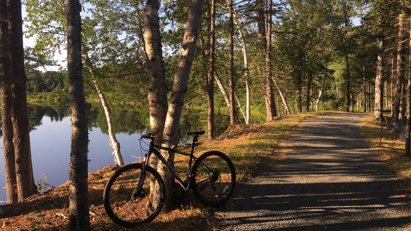
What’s there: Some (that serve asĚýski trails in the winter) along the East Branch of the Penobscot River, just south of the national monument. The private park opened just last year, andĚýit’s maybe the most manicured trail system in New England, where bikers still have to watch out for amblingĚýmoose and black bears.Ěý
Who runs it: , a philanthropic foundationĚýĚýretired finance titan Gilbert Butler, who bought the former timberland and funded construction of the trails and a pair of warming hutsĚýthat look like small national-park lodges.
Getting in: Park in a lot right off the paved state highway, sign in at a visitor center that may or may not be staffed, and hit the trail. There is no fee.Ěý
Know before you go: Ordinarily, Penobscot River Trails has a fleet of mountain bikes and kayaks (and in the winter, skis and snowshoes) to rentĚýby donation, although the rental program is on hold during the pandemic. No dogs, ebikes, or camping allowed.Ěý
What’s nearby: Not much! Medway, the next town south, has , a , and the rare lobster rollĚý100 miles inland atĚý.Ěý
Debsconeag Lakes Wilderness Area
What’s there: Some 46,000 nearly roadlessĚýacres of lakes and ponds, most of themĚýconnected by well-maintained portage trails and dotted with lakefront campsites. Also 15 miles of the Appalachian Trail, some stands of old-growth forest, backcountry ice caves, and so, so many loons.
Who runs it: , which acquired the property in 2002 from Great Northern Paper Company, once Maine’s largest landowner.
Getting in: In contrast to Baxter, Debsconeag is sparselyĚýregulated, with no permits, reservations, or fees. (No dogs are allowed, though.) Campsites are first come, first served and accessibleĚývia at the edges of the preserve.
Know before you go: As elsewhere, don’t count on cell service. Mountain bikes are verboten. You’ll want a vehicle with decent clearance to access the boat launches.
What’s nearby: The AT leaves the northeast corner of the DebĚýright next to the , a clutch outpost for last-minute tent stakes, fishing flies, and beer, as well as a staging area for northbound thru-hikers about to launch their final push towards Katahdin. It’s also a base camp forĚý on the West Branch of the Penobscot, which separates Debsconeag from neighboring Baxter.Ěý
Beyond the Katahdin Region: the North Maine Woods
Wait, isn’t it all the north Maine woods? Well yes, butĚýhead north or west along the rutted logging roads that spider out from the Katahdin region and sooner or later you’ll reach a gated checkpoint. This is run by , which administers recreational access to some 3.5 million acres of forests, mountains, lakes, and streams in the state’s undeveloped northeast corner.ĚýMost of the land is owned by commercial timber interests, but there are hundreds of remote campsites, plus a few sporting lodges and housekeeping cabins catering to anglers, hunters, and paddlers. Among other things, North Maine Woods regulates access to the 92-mile , one of New England’s . The Allagash has its own fee structure, but out-of-state visitors elsewhere in the North Maine Woods a $16 entrance feeĚýplus another $15 for each night of camping.
This story was produced in partnership with magazine.